
Map of Early Modern London
Item
Title
Map of Early Modern London
Creator
Project Leaders
Janelle Jenstad (Director)
Martin Holmes (Lead Programmer)
Mark Kaethler (Assistant Director, Mayoral Shows)
Janelle Jenstad (Director)
Martin Holmes (Lead Programmer)
Mark Kaethler (Assistant Director, Mayoral Shows)
homepage
https://mapoflondon.uvic.ca/index.htm
Description
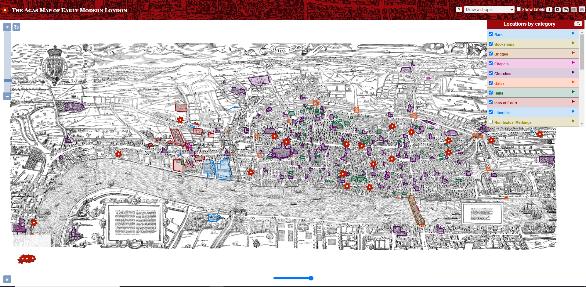
An interactive map of Early Modern London based on the Agas Map. Contains an encyclopedia of Gazetteers, a personography, placeography, orgography, articles on relevant historical topics, glossary of terms, a bibliography, and collections of digitized historical documents. The map resource collects these resources into a visually interactive form with overlays for different types of locational and geographical breakdown, with individual locations bringing up relevant information to that place.
Requirements
contribution: TEI encoding, XML
Alternatives
Pelagios?
Get Started
Usage of the primary map. Website navigation. Contribution: TEI encoding, XML