-
-
-

-
-

-

-

An interactive map displaying the state of the 9-10th century of middle eastern countries and the geospatial model of the early Islamic world.
Users can follow the map toward locations of significance along with searching for keywords, locations, and dates in both English and Arabic.
-

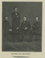
The project explores the visual life of Harriet Tubman in diverse illustrations. The students that created the project organized a visual archive of Tubman's representation, from photographs she took and her image in public memory.
-
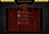
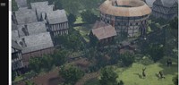
An interactive 3D space of P.T. Barnum's American Museum, which was burnt down on July 13th, 1865. Users can navigate through the digital re-creation of the museum by clicking on arrows to change their point-of-view and on objects within the re-creation to zoom in on them.
Along with the 3D re-creation is an archive of all the data used to make the resource accurate. Resources are searchable by name, theme, type of document, and exhibit.
The Classroom section of the website provides educators a simple way to teach alongside the program. There are a plethora of links that each provide a different experience for students to learn more about the museum and the time period.
-
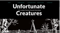
An interactive map that allows for one to search for narrative based on location
An interactive timeline with images and text that allows one to search for narrative based on dates.
An interactive list of types of natural disasters with specific years
A collaboration page with an email address for possible contact
-
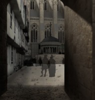
Recreates the experience of hearing John Donne's sermon on Gunpowder Day, November 5th, 1622. The project allows viewers to experience what the sermon would have sounded like at Paul's Churchyard, which the sermon was originally composed for, from eight different positions and four different crowd sizes. Virtual Paul's Cross Website also provides visual models of Paul's Churchyard and additional information on John Donne and the script for his sermon.
-
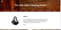
The John Milton Reading Room is a project dedicated to the preservation of John Milton’s poetry and Prose. It contains all of Milton’s poetry, written in English, Latin, Greek, and Italian. It contains a small collection of his prose, with every work being fully annotated. Serves as a library for Milton’s works, and provides a place to read all of his biggest works.
-
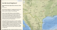
The site contains personalized accounts from Mexican American people of racism they experience, the accounts coming from Perales' third book, "Are We Good Neighbors?" (1948). The accounts are listed on the lefthand side of the site. When scrolling to a new account, the map of the United States (specifically Texas) on the right side of the site shifts to zoom in on the location where the racist incident took place, according to the account. It is possible to search for a specific city or address. This project stems from a larger Alonso S. Perales project, a collection at the University of Houston titled "Recovering the US Hispanic Literary Heritage."
-

As described on the website: "The Lost Plays Database is a wiki-style forum for scholars to share information about lost plays in England, 1570-1642. Its purpose is to add lost plays to scholarly discussions of early modern theatrical activity."
-
A collection of information about The Rose Theater that also includes computer generated models, and a few videos.
-
An interactive digital map of London. Marked on it is every recorded bomb dropped during the London Blitz from 7th Oct. 1940 till 6th June 1941. Along with an interactive marker that tells you where exactly each bomb was recorded to have gone off, coordinates, and present day address. Also included is the locations of 'pillboxes' (temp. military outposts) along with when they were set up. You can choose between the aggregate census (total), the first night of the Blitz, and the Weekly Bomb census
-
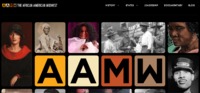
It is a database providing information on the history of the African American experience in the American Midwest. It specifically provides information on categories such as history, the midwestern states, and power. Furthermore, it provides an interactive map with information on anti-black violence in the midwest.
-
As stated by the site the editors of the site see a potential wealth of information on playwrites, venues in England, play companies, audience, and repertory writing.
-
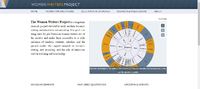
The Women Writers Project is a research project that is still on going but involves the process of bringing and resurfacing of Early Modern women's writing into the light through the use of quoting Early Modern women writers, graphing plays, and creating blog posts.
-
This project explores the Salem Witch Trials by using primary sources from the 17th century, including historical maps, books, letters, images, and court records. The project also explores the important people of the time period.
-

The Lost Plays Database is a wiki-style forum for scholars to share information about lost plays in England, 1570-1642. Its purpose is to add lost plays to scholarly discussions of early modern theatrical activity.
-
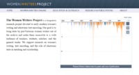
The Women Writers Project is a long-term research project devoted to early modern women's writing and electronic text encoding by bringing texts by pre-Victorian women writers out of the archive and making them accessible to a wide audience of teachers, students, scholars, and the general reader.
-
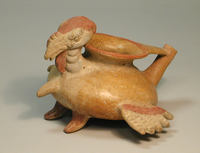
A vessel shaped like a female turkey used to make hot cocoa.
-
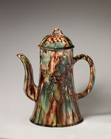
Talks about a coffee pot from 1755 in The Met Art Gallery.
-
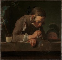
Inscription: Signed (left, on stone): ·J·chardin
